For the eighth year in a row, Meta has joined as a Bay Day partner to celebrate the heart of our home – San Francisco Bay.
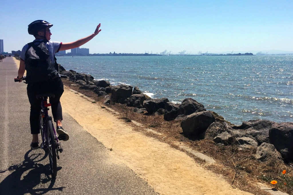
Bay Day is a chance for the Bay Area community to build our connection to the Bay, and find new ways to explore and enjoy it together. That’s easier to do when there is more shoreline to experience, and Meta has joined the effort to restore tidal marsh wetlands for humans and wildlife.
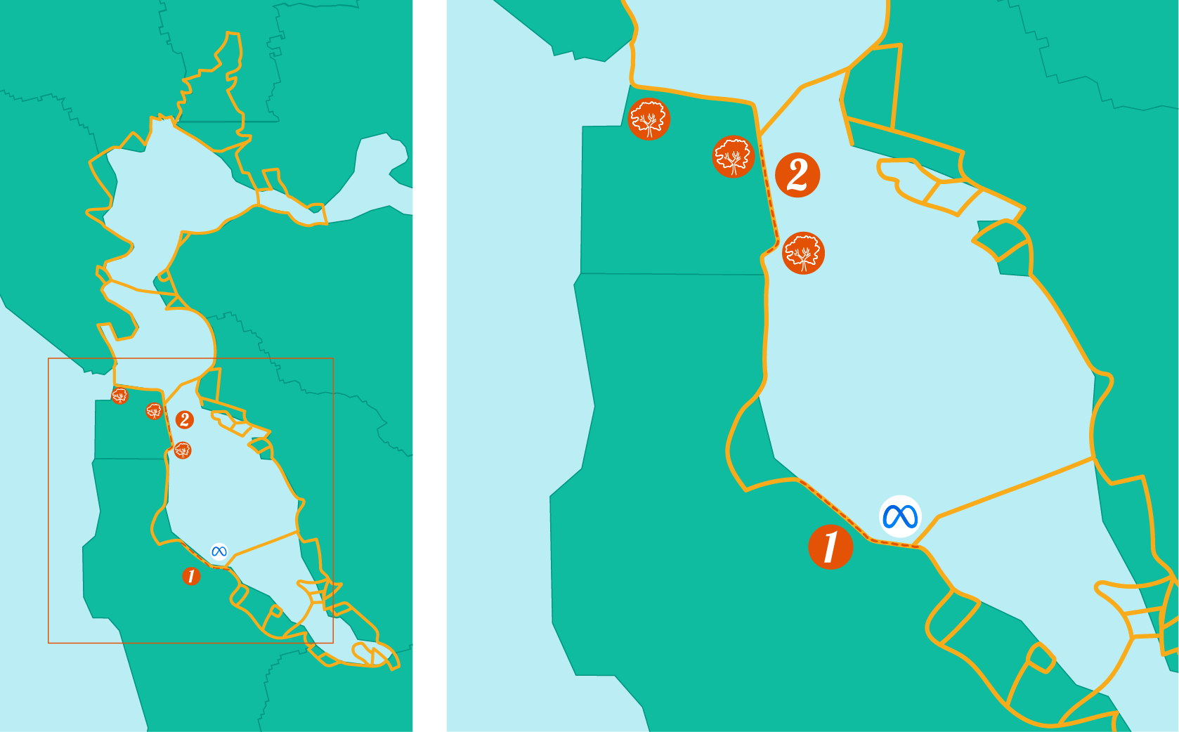
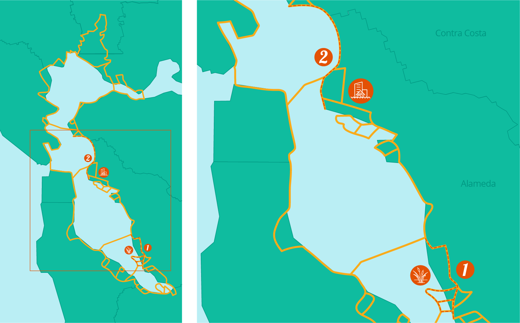
Meta is committed to climate adaptation and resilience, supporting nature-based solutions to battle rising seas. With the Bay shoreline bordering their headquarters, they’ve partnered on two restoration projects to protect their offices, as well as East Palo Alto and Menlo Park communities. Once completed, these two projects will result in ~900 acres of restored tidal marsh.
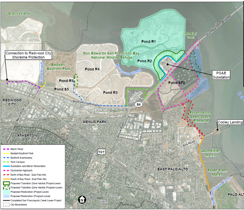
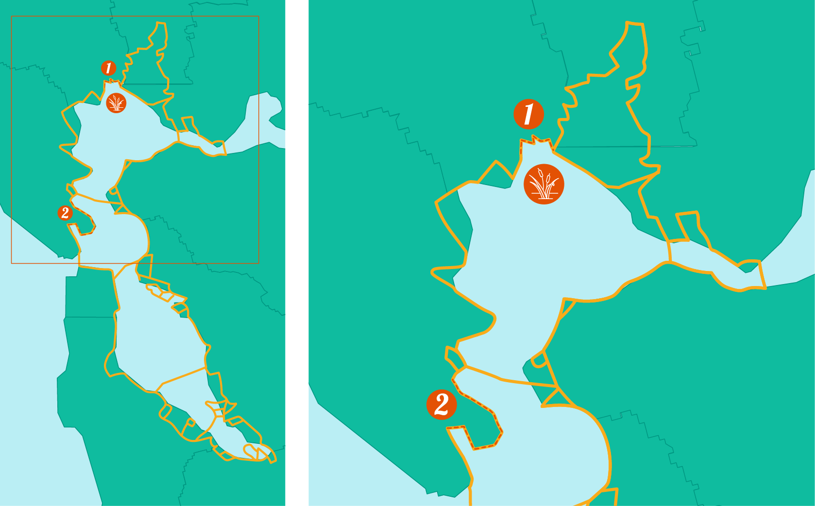
First, Meta is a partner of the SAFER Bay project – a plan that will create 600 acres of tidal marsh wetlands to sequester carbon, nullify storm surges, and absorb water during heavy rain events in winter.
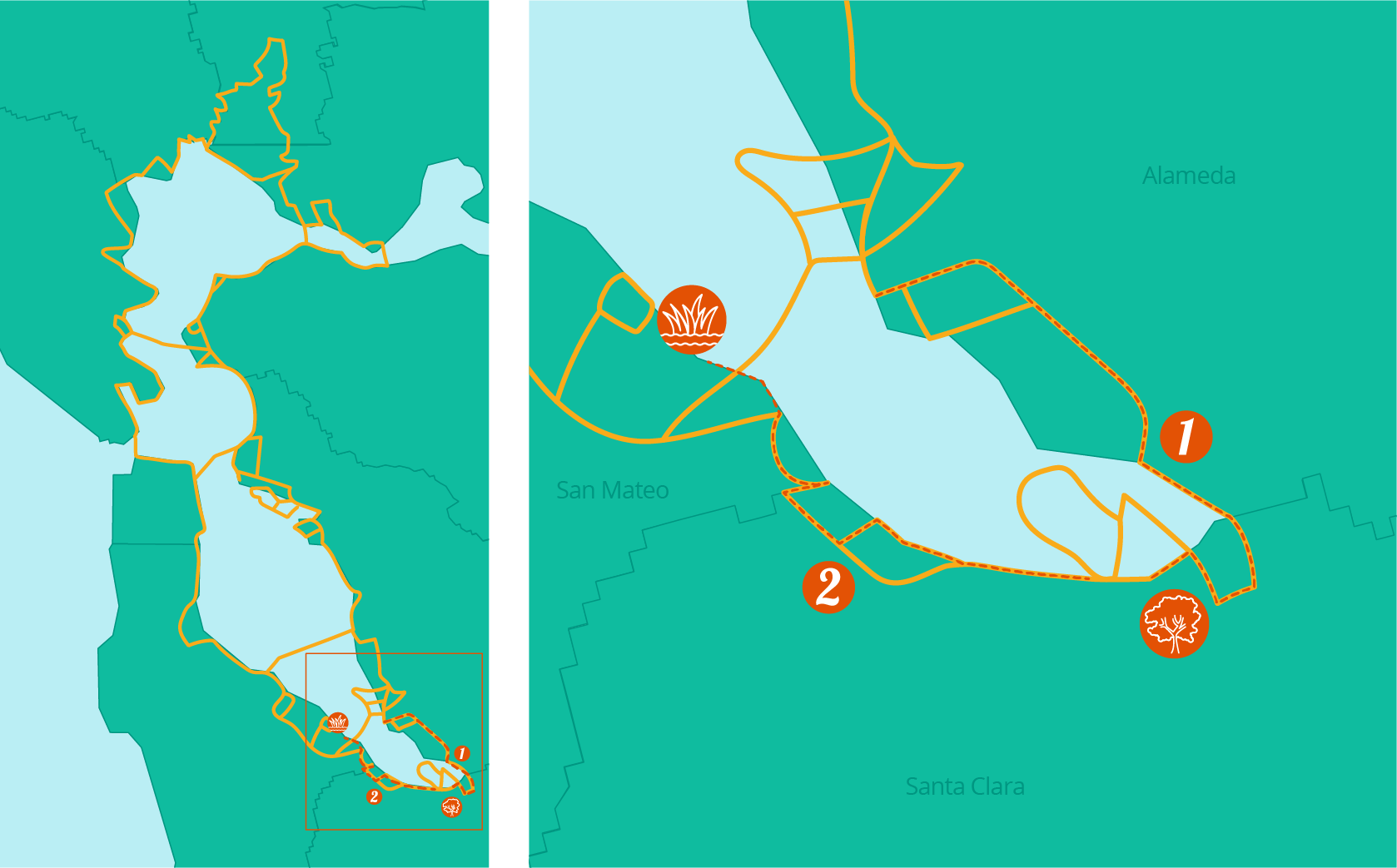
SAFER Bay Project Map
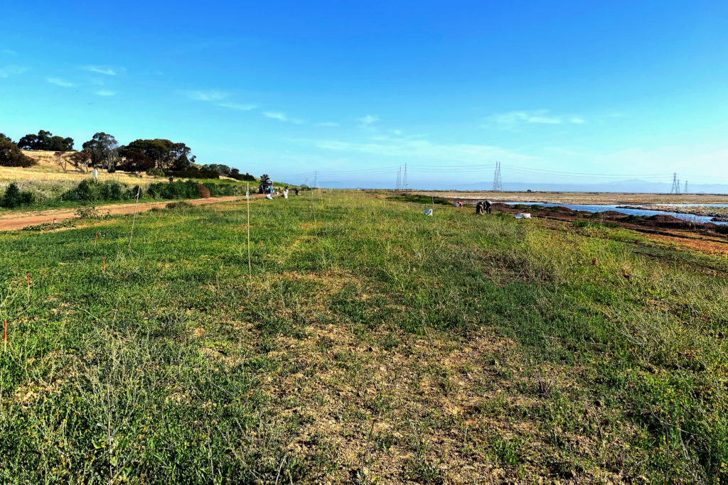
Second, Meta has helped Save The Bay with our horizontal levee projects on the east side of Bedwell Bayfront Park and along the All-American Canal which, when finished, will result in 294 acres of tidal marsh that protects thousands of homes in East Palo Alto and Menlo Park.
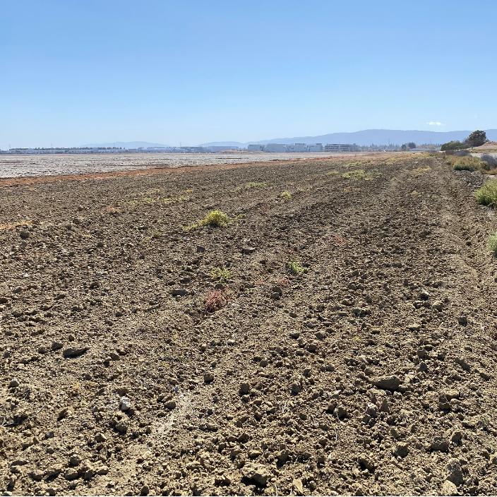
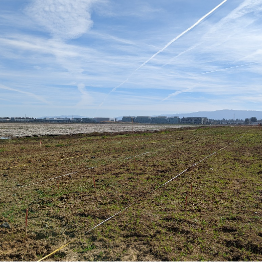
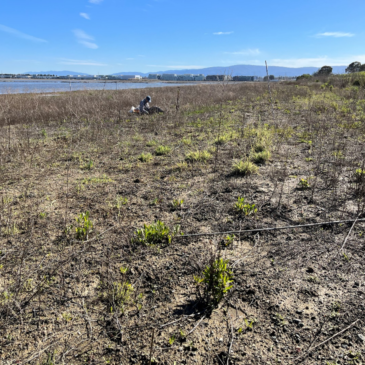
Ravenswood R4 Pond Horizontal Levee in November 2021 (left), March 2022 (center), and March 2023 (right)
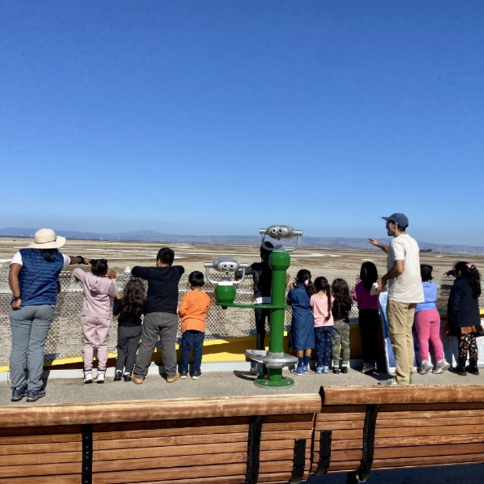
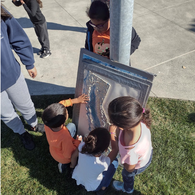
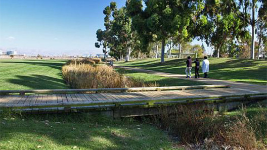
Restoring the shoreline increases access to open space that the community can take advantage of. In addition to funding restoration, Meta has partnered with Save The Bay to engage the Belle Haven community at Meta Park and on the shoreline. It’s important that the Bay shoreline be accessible to the community to use for recreation.
Bell Haven Community Program looking out at Ravenswood Pond complex (left) and exploring the watershed of San Francisco Bay (right)
Thank you to Meta for partnering with Save The Bay for Bay Day 2023 and helping build a resilient Bay for people and wildlife.
Get excited and get outside, because the Bay Day Challenge has officially begun!
Take on the 30 Mile Challenge or complete 10 Bay-related Activities. Run, bike, swim, walk, kayak, picnic, bird watch – on your own or with a team – there are so many ways to explore and celebrate Bay Day your way.
Challenge Guide
This year, we’ve made it easy for you to personalize your Bay Day. Our Challenge Guide includes a list of activities, trails, events, and much more. It is sorted by region and category, so that you can easily find Bay Day activities to suit you and your people. Our Bartable section even allows you to easily find public transportation to your Bay Day adventures. Whether you are an experienced biker or an art fanatic, this Challenge Guide is a great way to find and plan your Bay Day to connect with your community and your region.
Where: Martin Luther King Jr. Shoreline, Oakland When: October 7, 10 am – 3 pm
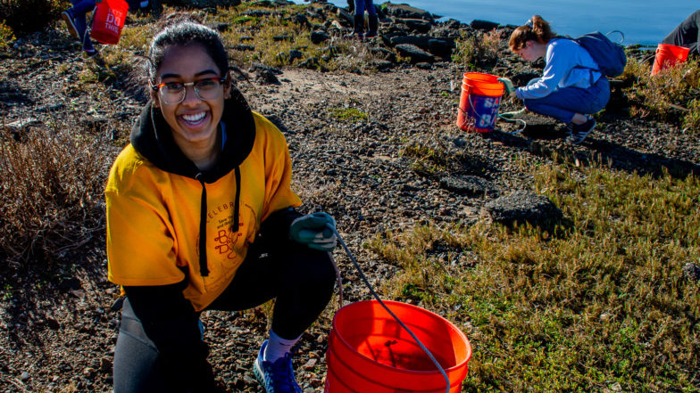
Save The Bay is hosting a special Bay Day Celebration to commemorate the month long event, and we hope you can make it! There will be a number of fun and impactful activities for all ages, including bird walks, shoreline cleanups, and native plant nursery programs. The first 100 attendees will also get commemorative Bay Day t-shirts and bags from our friends at Stasher. Register in advance and secure your spot to celebrate Bay Day with us!
Complete the Bay Day Challenge – 30 miles or 10 activities – and you will be entered to win our grand prize: San Francisco Bay Guided Kayak Tour with Sea Trek, for up to 12 people!
Two runners up will get $100 gift cards to Sports Basement, a local outdoor retailer. You can also share your adventures on Instagram and tag @saveSFbay #SFBayDay #BayDayChallenge for a weekly chance to win a $50 Sports Basement gift card.
Submit Your Results
Once you’ve hit a trail or completed an activity, head to the Bay Day RunSignUp portal and search for your name in Participant Lookup. Here you can submit your results to work towards winning the grand prize. If you have any questions, be sure to check out our FAQ.
Save The Bay invites you to celebrate your love of the San Francisco Bay with our annual Bay Day Challenge – presented in partnership with San Francisco Bay Trail.
Connect with your community, explore with friends and family, and rediscover the beauty of the Bay Area with the 30-day Bay Day Challenge. Choose how you celebrate: Tackle the 30 Mile Trail Challenge and hike, bike, swim, or walk the San Francisco Bay Trail or take on the Bay Activity Challenge and choose 10 fun Bay-related activities to complete.
Last year, over 1,200 Bay Day participants collectively traveled around 17,400 miles of the Bay Trail and completed 1,240 activities. Registration for this year is now open. Sign up and be a part of the fun!
To register, go to https://runsignup.com/Race/CA/Oakland/BayDay and fill out the sign-up form. Here, you can choose which challenge you want to tackle and decide to either join a team or create one yourself.
We can’t wait to see all that we accomplish with this year’s Bay Day celebration!
In 2022, Save The Bay invited people from all nine Bay Area counties to celebrate the 7th annual Bay Day. From September 2 – October 1, more people than ever before completed the 30-Mile Challenge or the Bay Activity Challenge to explore our region. Take a look at all that happened during last year’s Bay Day celebration, and get inspired for 2023.
Sign up to participate in the Bay Day Challenge before October 1st. Once you’ve completed your outdoor activities or hit the Bay Trail, submit your miles and activities to the Bay Day RunSignUp portal.
Don’t forget to follow us on Instagram and share your adventure with #BayDayChallenge #SFBayDay and tag @saveSFbay for the chance to win a $50 Sports Basement gift card every week.
Though this portion of the Bay Trail is not fully complete, there are four segments open to explore the marsh plain, sloughs, and mudflats of the northern San Pablo Bay: the Tubbs Island Trail, Sears Point Bay Trail, Sonoma Baylands Bay Trail, and the Port Sonoma Marina Trail. Note that the Tubbs Island Trail can only be accessed from the eastbound direction on Highway 37 and does not allow dogs. →
For this trail, bikers can travel south down the Tiburon Peninsula on Paradise Drive for beautiful views of the Bay. Hikers can begin in downtown Tiburon and walk along an old railroad alignment for around 3 miles before reaching Blackie’s Pasture where you can visit the statue of Blackie the horse. For more of an adventure, head to Strawberry Point and hike the Shoreline Spur Trail for even more bayshore views. →
Save The Bay grows between 35-100 thousand plants every year for our restoration projects. This means that every year we get to watch plants move through the beginning of their life cycle. We grow about 30 different native species, each with its own unique life cycle. Come tour our native plant nursery and learn about a very special marsh plant that you can see all over the Bay: marsh gumplant, also called by its scientific name, Grindelia stricta.
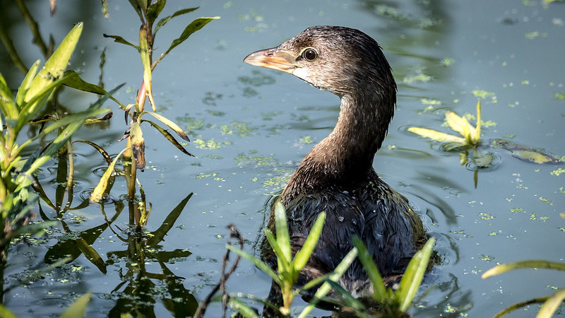
Grab a pair of binoculars and head to Las Gallinas Sanitary District Wildlife Area. Wastewater treatment plants often provide birders excellent opportunities to see marshland species from levee trails encircling ponds, and Las Gallinas includes wildlife viewing as part of its mission. Numerous waterfowl and raptors including Cackling Goose, Erurasion Wigeon, Osprey, Golden Eagle, Ferruginous Hawk, four species of falcon and the Great Horned Owl have been spotted here.
Redesigning Highway 37: A Regional Model for Multi-benefit Climate Resilience
Photo: Sonoma Land Trust
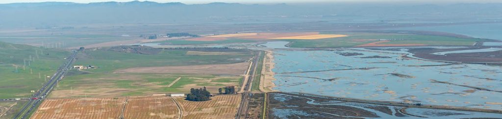
If your Bay Day adventures lead you to the shoreline trails along areas of the recently restored San Pablo Bay National Wildlife Refuge, you’ll definitely rely on Highway 37 to get there. You may not know it, but Highway 37 is actually one of the roads in the Bay Area most threatened by sea level rise. In fact, this narrow and chronically congested highway already suffers from flooding like in 2017 when it was closed for nearly a month after especially heavy rains. With rising tides due to climate change, in the coming years large stretches of this critical connection will be regularly underwater. But if done right, solving these flooding and congestion challenges could also be the key to restoring even more tidal marshes in the north bay – a lot more.
An effort being led by the Sonoma Land Trust is working to redesign Highway 37 to create a win for both the drivers who rely on it, and for the Bay by reconnecting more than 20,000 acres of restorable tidal marsh that are currently cut off by the highway. Ultimately, this effort is working with Caltrans to elevate Highway 37 along a causeway. Doing so will allow for congestion relief and ensure the new road is resilient to rising tides, while also allowing for the full restoration of the San Pablo Baylands.
To achieve these goals, we have to change how we measure the costs and benefits of an infrastructure project. Investing in an elevated Highway 37 is not just a simple road improvement project but is actually a regional model for multi-benefit climate resilience that will help the state meets its goals for using nature to fight climate change. And, since this is one of the largest potential shoreline restoration projects remaining in the Bay, if successful a future Bay Day visit to the area may have even more to offer.
This year’s Bay Day Challenge is now up and running, and Meta has once again showed its support for Save The Bay’s mission through sponsorship of the annual event. In addition to showing up for local organizations, Meta has demonstrated its commitment to combating climate change and promoting biodiversity at its offices and data centers around the world. Let’s take a look at some of the ways Meta is working to protect the environment near and far.
Green Roof
Meta’s Menlo Park headquarters is spearheading an effort to increase biodiversity in San Francisco Bay through the development of its 12.5-acre green roof and 11-acre campus park. The green roof features over 600 trees and 5,300 birds across a variety of habitats, including grasslands and oak savannas. The campus park has focused on diversifying tree species, particularly oaks, and planting trees that are adapted to the hotter, drier climate we are now experiencing in the Bay.
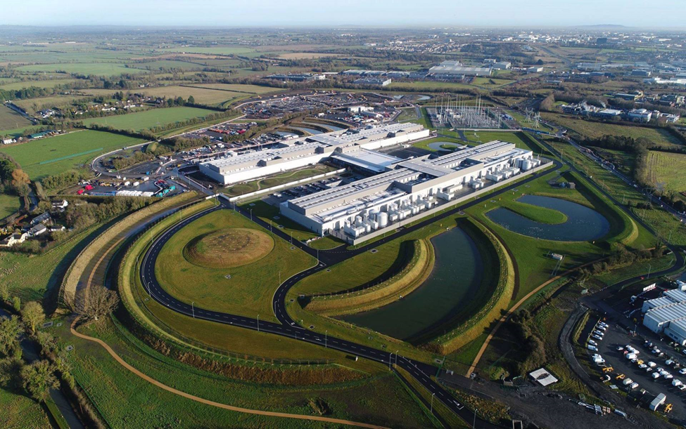
Data Centers
Across the country and the globe, Meta has constructed certified LEED Gold data centers that take each unique local habitat into consideration. After extensive research of each area, the buildings are designed to mimic the natural environment and reduce urban heat island effect by including native and adaptive species. In combination with efficient irrigation systems and sustainable wood products, these measures save over 80,000 kilogallons of water per year.
Watersheds
In addition to designing its data centers with water conservation in mind, Meta is working with local organizations in California, Arizona, New Mexico, and Utah to restore local watersheds. These projects reduce runoff, increase water storage capacity, and restore landscapes and rivers that increase wetlands and provide habitat for fish and vegetation. The results support nearby communities’ water supplies and help restore local habitats.
For more information on the many ways Meta is working towards a more sustainable future and to follow along on their journey to reach net zero emissions across its value chain, check out their sustainability website.
You can still sign up to participate in the Bay Day Challenge. Once you’ve completed your outdoor activities or hit the Bay Trail, submit your miles and activities to the Bay Day RunSignUp portal.
Don’t forget to follow us on Instagram and share your adventure with #BayDayChallenge #SFBayDay and tag @saveSFbay for the chance to win a $50 Sports Basement gift card every week.
This 15.2 mile trail begins at Anza Lagoon and hugs the shoreline until you reach San Mateo’s Ryder and Seal Point Parks. These parks feature playgrounds, picnic areas, and restored wetlands where you can launch kayaks, enjoy lunch, and observe the tidal water system. The trail continues further south to Belmont Slough where enthusiasts can continue to Redwood Shores Ecological Reserve for an even longer hike. →
Travel along San Francisco’s Southern Waterfront to take in sights new and old. Begin at Oracle Park and head south, passing by Agua Vista Park and the Chase Center. Visit Heron’s Head Park and India Basin Shoreline Park where you can step into Eco Center, the only 100% off-the-grid building in San Francisco. While Hunter’s Point Naval Shipyard is closed for redevelopment, take local roads to reach Candlestick Point State Recreation Area and Yosemite Slough. →
This Saturday is California Coastal Cleanup Day! If you can’t make it out to volunteer with us on the MLK Jr. Shoreline, you can clean up in your own neighborhood. Trash in our cities and roadways are responsible for a lot of the trash that gets into our creeks and into the Bay. By cleaning up your community, you are stopping trash from polluting our waterways, Bay, and ocean.
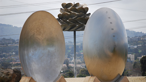
Check out the sleek metal sculptures as you stroll or ride through Seal Point Park in San Mateo. Some sculptures draw inspiration from natural forms and many interact with the wind and acoustics of their environment.
San Francisco Shoreline Parks
In the past two years, San Francisco has become home to several shoreline park restoration and construction projects that provide residents with more access to the Bay. Check out some of the new and upcoming park features across San Francisco.
India Basin Waterfront Park
As a former shipbuilding hub, India Basin has since been a historically under-resourced community leading to environmental pollution, rot, and lack of access to the Bay shoreline. The India Basin Waterfront Park Project was developed to clean up contamination from years of neglect, restore the tidal landscape, and produce a park with plenty of recreation opportunities. The project developed a community-driven Equitable Development Plan to “ensure this waterfront park will benefit current Bayview-Hunters Point residents while preserving the culture and identity of the historic neighborhood” as a commitment to environmental justice and equity.
Last year, the SF Bay Restoration Funding Authority awarded the project nearly $5 million to restore the shoreline and remove debris and dilapidated buildings. In August, the project celebrated completion of the 18-month cleanup phase, and on September 14th, the project broke ground on rehabilitation of the historic Shipwright’s Cottage and construction of a food pavilion, two piers, and more. Currently, the park features restored tidal salt marsh that provides fantastic opportunities for birdwatchers, kayak and trail access, and plenty of views of the Bay.
Crane Cove Park
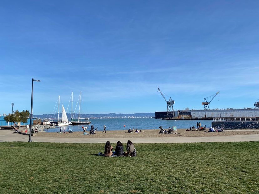
Crane Cove Park, located between Dogpatch and Mission Bay, is a 7-acre waterfront park providing much-needed green space and water access to its neighborhoods’ residents. Currently the park offers views of the historic cranes Nick and Nora that the park is named for, open areas for picnics and barbecuing, and a rocky beach for wading and boat-watching.
The Crane Cove Capital Campaign is ongoing with hopes of completing two children play areas, a dog run, a rehabilitation project on the crane tops, and several other projects.
Presidio Tunnel Tops
Newly opened above the Presidio Parkway Tunnels is the Presidio Tunnel Tops, featuring beautiful views of the Golden Gate Bridge. The outdoor play space encourages kids (and adults) to play as they would in nature with unique climbing structures and a water area. Check out the field station to do some hands-on learning about the flora, fauna, and history of the Presidio. For bigger history buffs, park rangers present historical anecdotes about people who have passed through the Presidio in Park Ranger Campfire Talks every Friday through Sunday. If you get hungry from all the exploring, grab a bite to eat at the various food trucks, tents, and carts across the park.
You can still sign up to participate in the Bay Day Challenge. Once you’ve completed your outdoor activities or hit the Bay Trail, submit your miles and activities to the Bay Day RunSignUp portal.
Don’t forget to follow us on Instagram and share your adventure with #BayDayChallenge #SFBayDay and tag @saveSFbay for the chance to win a $50 Sports Basement gift card every week.
Alviso is a historic waterfront town in the city of San José, located at the southernmost part of the Bay. The former marina has been restored back into wetlands and houses a variety of trails. As you explore you can see wetlands, brackish and freshwater marshes, and salt ponds. The nearby Environmental Education Center off of Grand Boulevard exhibits some interpretative displays of wetland wildlife and has its own 4.5 mile loop trail surrounding a restored salt pond. →
This trail begins at Bedwell Bayfront Park, heading southward into the Don Edwards San Francisco Bay National Wildlife Refuge and finishing at Alviso Marina County Park. From here you can explore the Ravenswood Open Space Preserve, discover the Lucy Evans Baylands Nature Interpretive Center, and visit the nearby Sunnyvale Baylands Park which features seasonal wetlands and grassy uplands that are great for picnicking. →
Save The Bay’s Habitat Restoration Team is currently monitoring restoration sites. In order to know where to focus our work, we systematically observe our site looking for a variety of species and habitat structures. This process is called monitoring and in this video, we’ll show you what monitoring looks like. Modeling our restoration strategy around the natural processes of these native habitats gives them the best chance for success well into the future.
Sunnyvale Baylands Park features fields to sit and relax on, playgrounds for the children, and beautiful trails to observe preserved wetlands. Baylands Park provides over seventy acres of developed parkland offering active recreation, pathways and picnic areas for families and large groups. An additional 105 acres of seasonal wetlands is protected as a Wetlands Preserve providing habitat for plants and wildlife.
Large-scale Restoration near Bedwell Bayfront Park
Ravenswood horizontal levee
On the southeast side of Bedwell Bayfront Park, Save The Bay is using innovative restoration techniques to create a nature-based solution to flooding and sea level rise. The 9.6 acre Ravenswood horizontal levee project offers a glimpse of what 21st century levees could look like in the Bay Area and beyond. By creating a wide, gently sloping, vegetated buffer of land, horizontal levees help prevent water from moving inland and protect communities from flooding and sea level rise. The restored native habitat will also provide crucial refuge for local wildlife.
For this large-scale project, Save The Bay is combining tried and true restoration methods of planting native species by hand with new strategies that utilize farming equipment to quickly spread rhizomes and seed mixes throughout the area. The Ravenswood horizontal levee is an important evolution in levee design and restoration technology, offering an example of how future shoreline adaptation projects can build resilience against climate change.
With recreational trails connecting to Bedwell Bayfront Park, Ravenswood is an easily accessible site to enjoy nature at the edge of the Bay.
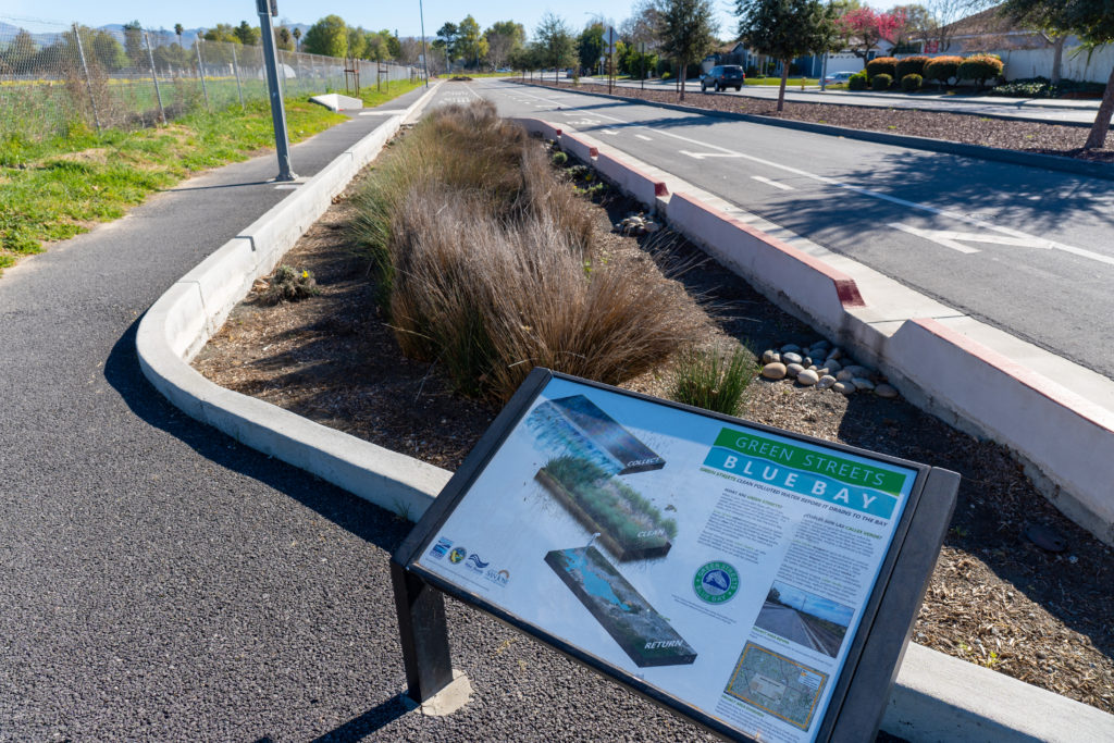
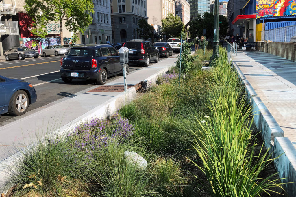
Urban Greening in San José
Chynoweth Street, San José
As climate change intensifies across the globe, Bay Area residents are grappling with the immediate impacts in the form of intense heat waves, unhealthy air quality and more frequent flooding, caused by rising sea levels and erratic weather patterns. For cities in the Bay Area, especially low-lying and shore-adjacent cities like San José, the importance of building climate resilience is becoming increasingly clear.
One of the most effective and transformative methods of building climate resilience is through urban greening. Urban greening incorporates nature back into urban areas, especially in vulnerable communities that have been historically underserved, in order to improve environmental health and community livability. By including features such as rain gardens, bioswales, and trees in planter boxes, cities can use natural systems to address some of the negative impacts of climate change.
The benefits of urban greening are vast. It can reduce the urban heat island effect, improve air quality, and buffer communities against flooding. Additionally, it creates more tranquil public spaces, which in turn can encourage active transportation and improve mental health. This nature-based, multi-benefit approach will not only protect the health and safety of residents, but can also make the city a more equitable and desirable place to live, work, and play.
San José has already made some investments in green infrastructure. The Park Avenue Green Streets Pilot Project, along Park Avenue between University Avenue and Sunol Street, includes 6,500 square feet of curbside rain gardens. These rain gardens replaced impermeable asphalt, and will help absorb and filter stormwater from surrounding roadways. On Chynoweth Avenue, 5,600 square feet of curbside rain gardens replaced what was once asphalt. The rain gardens host drought tolerant plants and tree wells to absorb and filter stormwater. Take a walk for your Bay Day Challenge to see urban greening in action in San José!
30 Days of the Bay starts now! Whether you are traversing 30 miles of the San Francisco Bay Trail or completing 10 Bay-related activities, here is your guide to taking on the Bay Day Challenge in the East Bay. Check back every week for other Bay Area regional spotlights on new trails, key partners, and inspiring projects – discover what makes our region so special, and get motivated to explore.
Once you’ve hit the Bay Trail or engaged outdoors, submit your miles and activities to the Bay Day RunSignUp portal. Don’t forget to follow us on Instagram and share your adventure with #BayDayChallenge #SFBayDay and tag @saveSFbay for the chance to win a $50 Sports Basement gift card every week.
This 12 mile walking and biking trail begins at the Don Edwards San Francisco Bay National Wildlife Refuge Headquarters and ends at the Hayward Shoreline Interpretive Center. Along the way you will find Coyote Hills Regional Park and a Visitor Center filled with wildlife and wetland display exhibits. Pass by Eden Landing Ecological Reserve where you can find fishing ponds and picnic sites. →
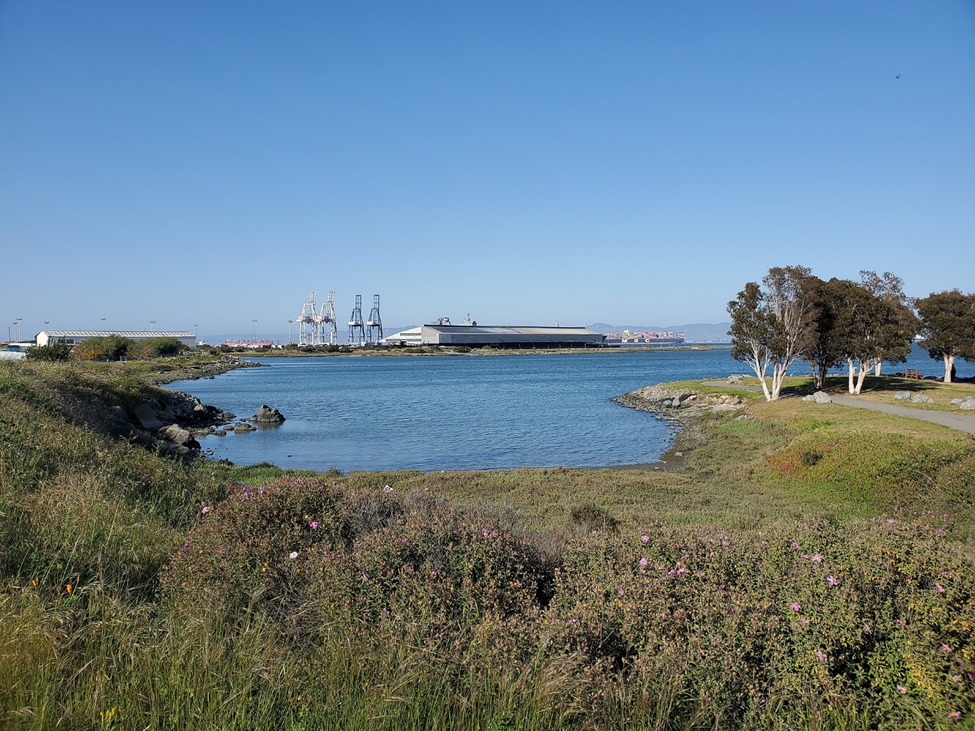
Begin this 15.3 mile trail at the Port of Oakland and visit Portview Park and Middle Harbor Shoreline Park for views of the Bay Bridge and San Francisco skyline. Head north and pass through the Emeryville City Marina and McLaughlin Eastshore State Park, named for Save The Bay co-founder Sylvia McLaughlin! The trail ends at the Albany Mudflats Ecological Reserve where you can find the Albany Bulb and beautiful Bay views. →
Check out our OLO Ecosystem Explorer video to learn how to identify and explore different types of ecosystems around San Francisco Bay. →
Download our Ecosystem Explorer Guide and explore an open space near you. Use this activity worksheet to make observations, collect evidence of biotic and abiotic factors, and create your own guide.
Participate in a Clean Up
Pollution prevention is one way we can help conserve and restore the Bay. Join us throughout the East Bay to help remove trash before it ends up in our waterways, Bay, and ocean.
Coastal Clean Up Day: September 17
Save The Bay, MLK Jr. Regional Shoreline in Oakland →
Creek to Bay Day, City-sponsored clean up sites throughout Oakland →
Bay Day Bash: October 1
Save The Bay, MLK Jr. Regional Shoreline in Oakland and sponsored by Meta →
Climate Resilience in Oakland and Beyond
The City of Oakland is currently updating its General Plan, a blueprint that will guide the City’s development in the coming decades. Over the past months, Save The Bay has been advocating for climate resilience to be prioritized in the General Plan Update process. This has included meeting with City staff and community stakeholders, as well as attending outreach events and submitting comments on the General Plan elements.
One major milestone in our Oakland General Plan work was the passage of a citywide resolution incorporating climate resilience and adaptation measures into the General Plan update. This resolution, sponsored by Councilmember Dan Kalb and President Pro Tempore Sheng Thao, called for the General Plan to work towards “healthy, resilient communities that are equipped to thrive in the face of climate hazards.” It directs City staff to prioritize environmental justice outcomes for frontline communities, and requires climate resilience to be incorporated into housing, infrastructure, and other related issues.
This Oakland resolution will help ensure that the city is resilient to climate impacts in the coming decades. It also serves as a model of climate resilience planning throughout the Bay Area. If cities across our region incorporate resilience into their planning processes, it will move us towards a safer and more environmentally just Bay Area.
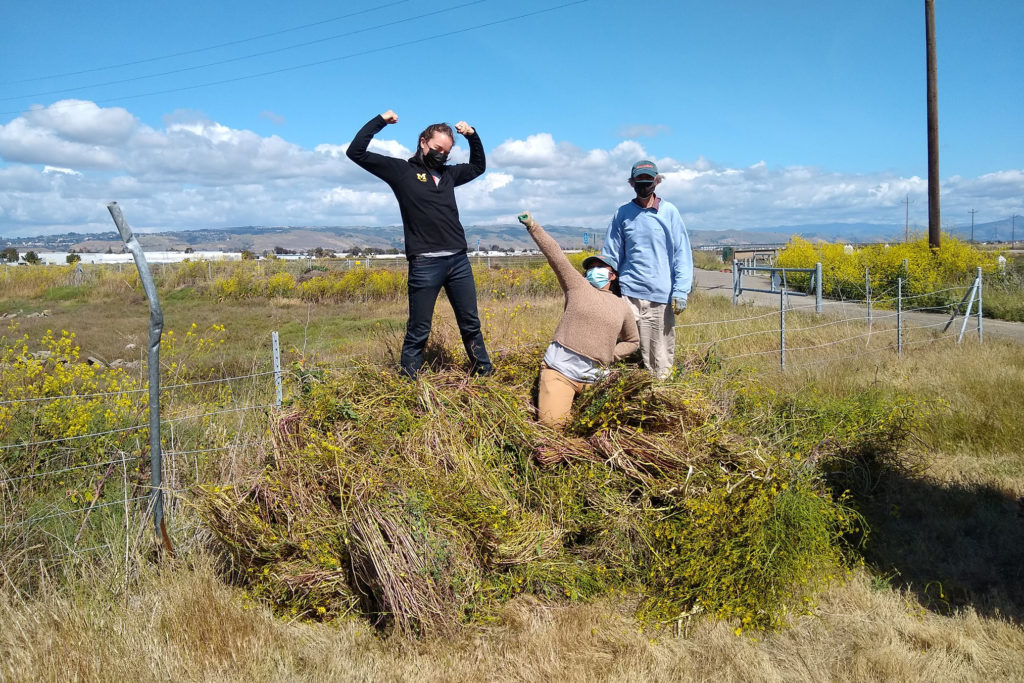
A Decade of Habitat Restoration at Eden Landing
Eden Landing Ecological Reserve (ELER) is one of our staff members’ favorite sites for viewing wildlife, exploring transition zone habitats, and witnessing change on the landscape. This 6,400-acre reserve of restored salt ponds, marshes, and upland habitats has been a restoration location for Save The Bay for over a decade. We partner with the California Department of Fish and Wildlife to complete this work and have successfully restored 8 transition zone sites, totaling over 6 acres.
In the spring of this year, we launched into work on our ninth site! A new site begins with plenty of weeding: removing species that grow quickly and take over the landscape to make more room for natives. With the help of volunteers, we removed over two tons of weeds from our new site this spring. As the (hopefully) rainy season approaches, we will begin planting a diverse selection of native species, creating habitat for wildlife, and providing many additional ecosystem services.
If you head out to Eden Landing this month, walk along the road from the parking lot toward the kayak launch. The left side of the trail is a site we restored ten years ago. The right side is our new site. Take your time to observe the similarities and differences between the two. Send us any questions that come up as you explore. Enjoy!
Now that our 6th annual Bay Day is officially over, we want to thank you all for making it such a success! From walking the trail, sharing the challenge with your friends and families, tagging us in your posts on Instagram, and logging your miles, you all found unique and inspiring ways to celebrate San Francisco Bay.
This year we had 1,077 people who walked, biked, hiked, kayaked, and explored San Francisco Bay as part of the Bay Day Trail Challenge. We had participants from every county of the Bay join us, covering 19,774 miles of trail in total and completing 428 activities. We hope that in participating in this year’s Bay Day, you were able to connect with the Bay around you.
Thank you again for joining us for Bay Day 2021 – we can’t wait to see you next year!
We Want to Hear from You
Did you enjoy Bay Day? Can you think of ways to make Bay Day better? Your Trail Challenge experience is important to us. Fill out this short survey to help us improve next year’s Bay Day!
The first 25 responses who have not yet received Bay Day swag will be sent a limited-edition Bay Day t-shirt.